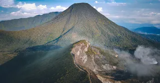
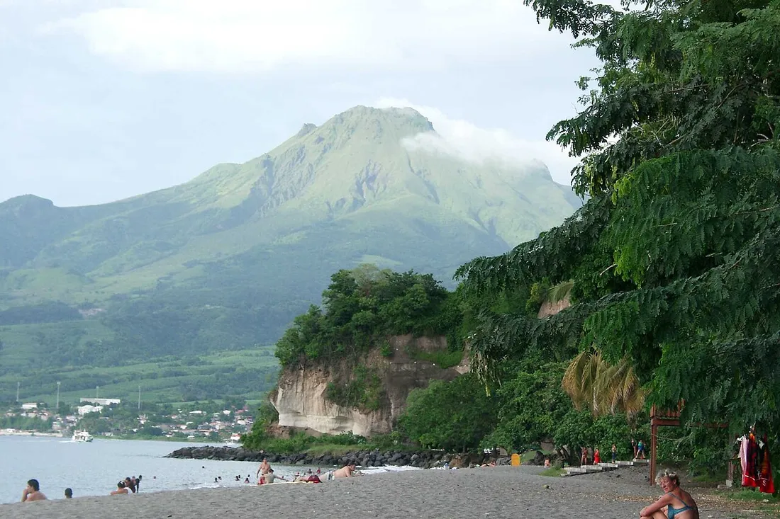
The highest point in Martinique, Mount Pelée is a legendary volcano, now listed as a UNESCO World Heritage Site. Between its steep trails, its panoramas over the Caribbean Sea, and the tropical forest that surrounds it, it is one of the finest adventures on the Island of Flowers. But it is also an active, monitored volcano, where the weather can turn in a matter of minutes. Here is our complete guide to making your climb a safe success, then rounding out the day with the sublime Route de la Trace, its Balata garden, and the historic town of Saint-Pierre.
Mount Pelée at a glance
Rising to 1,395 m, Pelée is the highest point in Martinique. Since September 2023, its spectacular landscapes, along with those of the pitons and mornes of the North, have been inscribed on the UNESCO World Heritage List — a recognition that rewards both the beauty of these places and their exceptional geological interest.
The volcano remains sadly famous for the eruption of 8 May 1902, which destroyed the town of Saint-Pierre in just a few minutes — then nicknamed the “Little Paris of the West Indies” — and claimed tens of thousands of lives. This disaster left its mark on the history of modern volcanology. Today, Pelée is one of the most closely monitored volcanoes in the world, under the permanent watch of the Martinique Volcanological and Seismological Observatory.
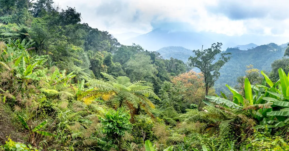
Climbing Pelée is therefore far more than a hike: it is walking on living, history-laden ground, where nature has reclaimed its place in a backdrop of ash, giant ferns, and shifting clouds.
Which trails lead up Mount Pelée?
Three main routes lead toward the heights of the volcano. Each has its own character, difficulty, and viewpoints.
- L’Aileron (departure from Morne-Rouge) — the shortest and most popular, ideal for a first climb. The trail begins at a developed car park at altitude, which reduces the elevation gain. Wooden and stone steps, with handrails in places: it is physical but well marked. This is the recommended choice if you are discovering Pelée for the first time.
- La Grande Savane (departure from Prêcheur) — the most spectacular. It crosses vast grassy expanses open to the Caribbean Sea, with grand panoramas over the coast. Longer and more exposed to wind and sun, it is suited to seasoned hikers.
- The Sentier des Chinois / Basse-Pointe — the longest and wildest. It climbs through dense vegetation from the northeastern slope and demands good physical condition as well as real hiking experience.
Whichever route you take, the true summit (la Calebasse or le Chinois) has to be earned: after reaching the edge of the first plateau, there is often a further climb into the caldera, sometimes windy and lost in fog.
Which trail to choose for your level
- First time, or family with sporty teens: l’Aileron, without hesitation.
- Experienced hiker after the scenery: la Grande Savane, in clear weather only.
- Seasoned walker, full day out: Basse-Pointe and the wild slopes.
How hard is it, and how much time should you plan?
The climb is difficult — do not underestimate it. The positive elevation gain is around 600 m over a fairly short distance, which makes for a sustained gradient. Add to that high steps, volcanic rock that is slippery when wet, and loose ground in places.
Plan for roughly:
- L’Aileron: 4 to 5 hours round trip to the first refuge and the crater rim, more if you push on to the summit.
- La Grande Savane: 5 to 7 hours depending on pace and visibility.
- Basse-Pointe / les Chinois: 6 to 8 hours, for trained hikers.
It is not a technical mountaineering challenge, but a real cardio and muscular effort, intensified by the tropical humidity. Walk at your own pace, take breaks, and don’t hesitate to turn back if conditions deteriorate: the mountain will always be there.
Essential gear and preparation
Good preparation makes all the difference on Pelée. Be sure to bring:
- High-top hiking boots with good grip (smooth soles are dangerous on wet volcanic rock).
- A waterproof windbreaker: even with full sun at the bottom, it can be cool and windy at the top.
- Plenty of water: at least 1.5 to 2 litres per person, as there is no drinking-water point.
- Energy snacks (dried fruit, bars).
- A hat or cap, sunscreen, and sunglasses, especially on open trails like la Grande Savane.
- A change of clothes kept dry in the car for the way back.
- A charged phone and an offline map app; coverage is patchy.
A little seasonal tip: travel light but complete. There is no need to overload yourself, but never skimp on water, the windbreaker, and your footwear.
Weather and safety: the golden rules
This is the most important section. Pelée draws in the clouds: the summit is very often in fog, sometimes as early as mid-morning. Visibility reduced to a few metres can make you lose the trail, especially inside the caldera.
Our safety recommendations:
- Set off very early (ideally before 7 a.m.) to enjoy the morning clear spells and avoid the afternoon humidity.
- Check the local weather and the volcano’s conditions before leaving; give up without regret if the sky is closed in or rain is forecast.
- Stay on the marked trails: the vegetation and ravines hide dangers.
- Never set off completely alone on the long, wild routes, and tell someone your plans.
- Follow the official guidelines: as the volcano is active and monitored, access restrictions may occasionally be put in place. Check with the town hall or the tourist office.
If in doubt, consider a local hiking guide: their knowledge of the terrain and the weather is a real source of peace of mind, and they enrich the outing with geological and historical anecdotes.
The Route de la Trace: the island’s most beautiful drive
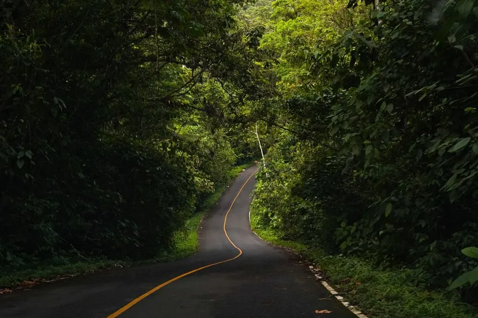
On the way to or from the climb, don’t miss the Route de la Trace (the N3), originally laid out by the Jesuits in the 18th century. It winds between Fort-de-France and the north through a lush tropical rainforest: tree ferns, giant bamboo, vines, and a dense canopy form a spectacular tunnel of greenery.
It is a twisting road, best driven slowly, windows down, stopping at the viewpoints. Along the way, several more accessible walking trails let you sample the forest without the effort of the volcano. To roam it freely and reach the often-isolated trailheads, a car rental is all but essential in the north of the island.
The Balata Garden, an unmissable stop
About fifteen minutes north of Fort-de-France, the Balata Garden is one of the most beautiful botanical gardens in the West Indies. You wander among thousands of tropical species, water-lily ponds, hibiscus, and flamboyant heliconias, with the added bonus of suspended bridges in the canopy offering a bird’s-eye view over the vegetation. It is a perfect stop — gentle and shaded — ideal after the effort or on days when Pelée stays hidden. Find out everything in our dedicated guide to the Balata Garden.
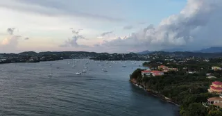
Saint-Pierre and the volcano’s history
It is impossible to talk about Pelée without visiting Saint-Pierre, nestled at the foot of the volcano by the sea. Rebuilt on its own ruins, the town still bears the marks of the 1902 eruption: remains of the theatre, the dungeon of Cyparis (one of the few survivors), and old foundations. Its volcanology museum tells the story of the disaster, and of life before it, with real emotion.
Now designated a City of Art and History, Saint-Pierre charms visitors with its peaceful atmosphere, its black-sand beaches, and its seabed prized by divers (the 1902 wrecks). It is the perfect cultural complement to the hike. To round out your stay around the north and the capital, take a look too at our ideas in what to do in Fort-de-France.
Combining volcano, forest, and beaches: the ideal itinerary
To make the most of the north, spread your exploration over two or three days:
- Day 1: climb Pelée via l’Aileron, leaving at dawn, returning in the early afternoon.
- Day 2: the Route de la Trace, the Balata Garden, then Saint-Pierre and its museum.
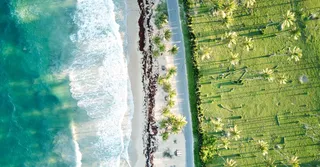
- Day 3: relax on the northern beaches (black sand of Anse Couleuvre, Anse Céron) or head south toward the best beaches in Martinique to wind the trip down gently.
This sequence lets you experience the three faces of Martinique: the wild mountain, the primary forest, and the coastline. Just remember to alternate effort and rest, and to keep a buffer day in case the weather on the volcano turns fickle.
Practical tips in brief
- Level: difficult (Aileron) to very difficult (Basse-Pointe, Grande Savane).
- Duration: 4 to 8 hours depending on the route.
- Best time: the dry season, from December to April, with clearer skies.
- Start time: early in the morning, without fail.
- Essentials: water, windbreaker, hiking boots, snacks, charged phone.
- Safety: marked trails only, weather checked, turn back without hesitation if it fogs over.
Where to stay to explore northern Martinique?
To reach the volcano and the Route de la Trace easily, choose well-located, comfortable accommodation where you can rest after the effort. Explore our accommodation in Martinique and all of our accommodation in the West Indies to put together the stay that suits you best.
At Hostel Toucan, we love sharing our insider tips: the best weather windows, the trails of the moment, the north’s tastiest addresses, and car rental to roam the Trace in complete freedom. Book your accommodation now with Hostel Toucan and set off to conquer Mount Pelée with peace of mind.