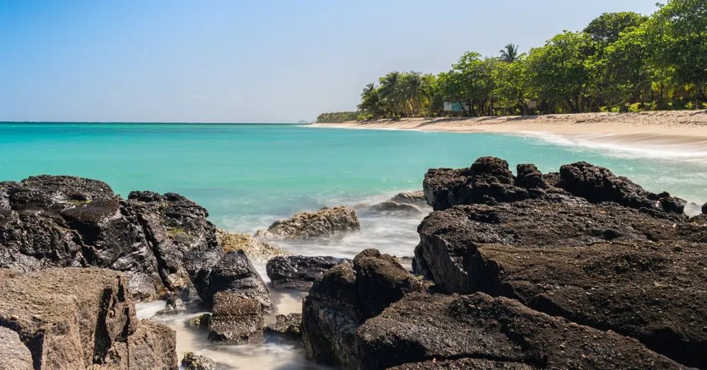
Before you lace up your boots for La Soufrière or the Carbet Falls, one thing must be made clear: hiking in Guadeloupe National Park comes with precise rules, and they are enforced. Created in 1989, Guadeloupe National Park protects roughly 17,000 hectares of humid tropical forest on Basse-Terre, the mountainous wing of the butterfly, plus the Pigeon Islets of the Cousteau Reserve and the Grand Cul-de-Sac Marin. I live ten minutes from the Maison de la forêt and every week I meet visitors surprised to learn that their drone, their dog or their wild-camping plan is forbidden. Here is everything you need to know to hike by the rules, with no bad surprises and no fines.
Park core and adhesion area: understanding the two zones
The regulations depend entirely on where you set foot. The National Park operates with two distinct perimeters.
The park core: the most protected zone
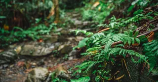
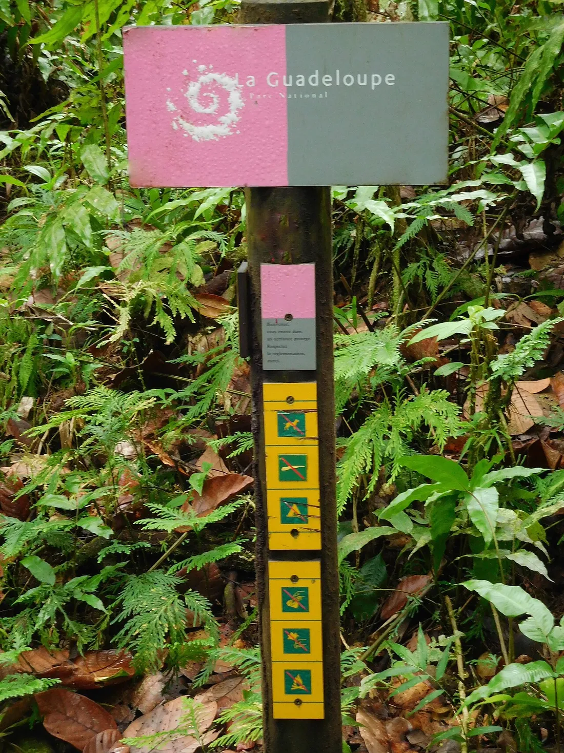
The park core covers the summits and dense forest of Basse-Terre: the La Soufrière massif (1,467 m, the highest point in the Lesser Antilles), the Carbet Falls, the Route de la Traversée around the Maison de la forêt, the Bouillante pitons. This is where the strictest park-core rules apply, marked by signs bearing the brown pelican, the Park’s emblem. Everything that follows in this article concerns this zone first and foremost.
The adhesion area: partner municipalities
Around the core, 11 municipalities including Bouillante, Deshaies and Pointe-Noire form the adhesion area. The regulations there follow ordinary law: more flexible, but municipal by-laws (parking, river access) still apply. In practice, a beach such as Grande Anse in Deshaies is not subject to the park-core bans.
What is forbidden on the protected trails of Basse-Terre
Here is the list that avoids 90% of trouble. These bans appear in the decree that created the Park, and breaches can cost from €68 (simple fine) to €1,500, or even more in case of repeat offence or serious harm to the environment.
- Wild camping and tenting are forbidden in Guadeloupe on the park-core side: no tent, no overnight hammock, no night under the stars on the trails. The ban also applies to the summit of La Soufrière, despite the temptation of sunrise. The only exception: a few shelters and tolerated areas outside the park core, to be checked with the town halls.
- Drones forbidden: any overflight of the park core below 1,000 m altitude is prohibited without written authorization from the Park. The aerial images of La Soufrière you see online have (in principle) been granted a waiver. Possible fine and confiscation of equipment.
- Dogs and domestic animals forbidden, even on a leash, even carried in a bag. The local fauna (Guadeloupe woodpecker, racoon, hylodes) is highly sensitive to disturbance. Leave your companion at the accommodation.
- Foraging forbidden: flowers, tree ferns, seeds, volcanic rocks, even a simple “souvenir.” The heliconias and wild pineapples stay where they are.
- Fires forbidden: no stove, barbecue or campfire in the park core. The fitted picnic shelters (Maison de la forêt, Grand Étang) are the only option for a sit-down lunch.
- Waste: nothing gets thrown away, everything comes back down, including organic waste (a banana peel takes more than a year to break down at 1,200 m altitude).
- Amplified music and off-trail mountain biking are not allowed: silence and walking remain the norm on the core trails.
And swimming in the rivers and pools?
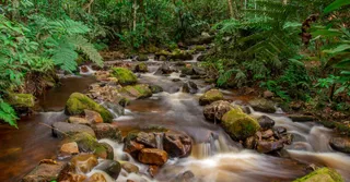
It is tolerated in most pools (Cascade aux Écrevisses, Bassin Paradise), but soap and shampoo are forbidden, even biodegradable ones. After heavy rain, beware of flash floods: the rivers of Basse-Terre rise within minutes.
The Park’s main trails: access, durations and real prices
Good news: access to hiking in Guadeloupe National Park is free. You only pay for certain car parks and services. A few concrete benchmarks, checked on the ground.
La Soufrière via Bains Jaunes
- Start: Bains Jaunes car park (Saint-Claude), free, about 45 minutes’ drive from Le Gosier or Sainte-Anne.
- Climb to the summit: allow 3h30 to 4h round trip, 8 km, 600 m of positive elevation gain since the closure of the access road to the Savane à Mulets.
- Set off before 7 a.m.: the summit clouds over almost systematically by late morning, and it can be 12°C up there with a violent wind. A windbreaker is essential, even in the dry season (December to April).
- Stay on the marked trail at the summit: the fumaroles release acidic gases and some areas are closed by prefectural decree depending on volcanic activity.
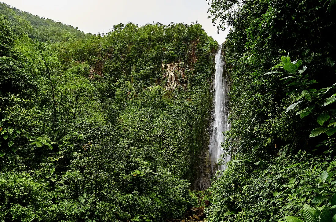
The Carbet Falls
- Access via Capesterre-Belle-Eau, Route de l’Habituée. The fitted site charges a fee: about €2.50 per adult, free for under-12s, and the entry funds the upkeep of the walkways.
- Second fall (110 m): 50 minutes round trip on a fitted trail, family-friendly.
- First fall and the pool of the third: more demanding routes (3 to 4 h), sometimes closed after rockfalls. Check the state of the trails before setting off; closures are frequent.
Route de la Traversée and Maison de la forêt
- Cascade aux Écrevisses: 10 minutes’ walk, ideal with children, but arrive before 9:30 a.m. on weekends, as the car park fills up.
- Trace des Ruisseaux or the Bras David loop: 1 to 2 h in a forest of large-leaved chestnuts and spectacular white gum trees.
- The “Trace des Alizés” regional GR trail crosses the massif over some forty kilometres: feasible only in day sections, since wild camping is forbidden in the park core.
Preparing your hike well: a local’s instincts
- Check the weather and the alert level (Météo-France Guadeloupe) the very morning: a rainy spell on the heights changes everything.
- Plan 1.5 to 2 litres of water per person; tropical humidity dehydrates fast.
- Closed hiking shoes: the volcanic trails are greasy and slippery all year round, and flip-flops regularly send tourists to the emergency room.
- Phone signal is nonexistent over long stretches: tell someone your route and your return time.
- No night hiking in the park core without authorized supervision.
To place these trails within a complete itinerary spanning the volcano, the Cousteau Reserve at Malendure and the beaches of Grande-Terre, our complete guide to Guadeloupe details the best combinations depending on the length of your stay.
Where to stay to reach the National Park’s trails?
Logistics make a hiking week a success. Sleeping in Saint-François when you tackle La Soufrière at 6 a.m. means 1h15 of driving before the effort. Two strategies work well:
- Base yourself on the Basse-Terre side (Bouillante, Deshaies, Saint-Claude) to string together La Soufrière, the Carbet and the Route de la Traversée within 30 to 45 minutes’ drive, with snorkeling at the Cousteau Reserve on rest days.
- Split the stay in two: a few nights on the volcano side, then the beaches of La Caravelle in Sainte-Anne or the Pointe des Châteaux to finish gently.
At Hostel Toucan, we offer rentals in Guadeloupe selected on both wings of the butterfly, with direct booking and no platform fees, free cancellation up to 7 days before arrival and WhatsApp assistance 7 days a week — handy when a trail closes at the last minute and you have to reorganize the day. And if you own accommodation near the Basse-Terre trails, our concierge service for owners showcases it to hiking travellers who respect the land.
FAQ
Do you have to pay to hike in Guadeloupe National Park?
No, access to the trails is free. Only certain fitted sites charge a fee, such as the Carbet Falls (about €2.50 per adult), which funds the upkeep of the walkways and the securing of the site.
Can you wild camp or sleep at the summit of La Soufrière?
No. Wild camping, tenting and fires are forbidden throughout the park core, including the summit of La Soufrière. Night hiking with a headlamp in the park core is also not permitted without supervision: the legal solution for a sunrise at the summit is to set off from Bains Jaunes at dawn, around 5:30–6 a.m.
Are drones allowed over the Carbet Falls?
No. Overflying the park core below 1,000 metres altitude is forbidden without a written waiver from the National Park. The offence exposes you to a fine and confiscation of the drone, and sworn officers patrol the busiest sites.
What is the best time to hike in Basse-Terre?
The dry season, from December to April, offers the least muddy trails and the best rate of clear summits. The rest of the year, hike early in the morning and watch the weather alerts: flash floods in the rivers are the leading risk for hikers in Guadeloupe.