If the classic Soufrière trail left you wanting more, the Tête Allègre and Nez Cassé hike is the logical next step. This volcanic loop on the heights of Basse-Terre takes you far from the crowds: wind-battered ridges, fumaroles, cloud forest and sections where you’ll need to use your hands. I tackle it several times a year, and I’ll say it up front: this is a route for experienced hikers, not a family stroll.
Why choose the Tête Allègre and Nez Cassé hike over the classic Soufrière
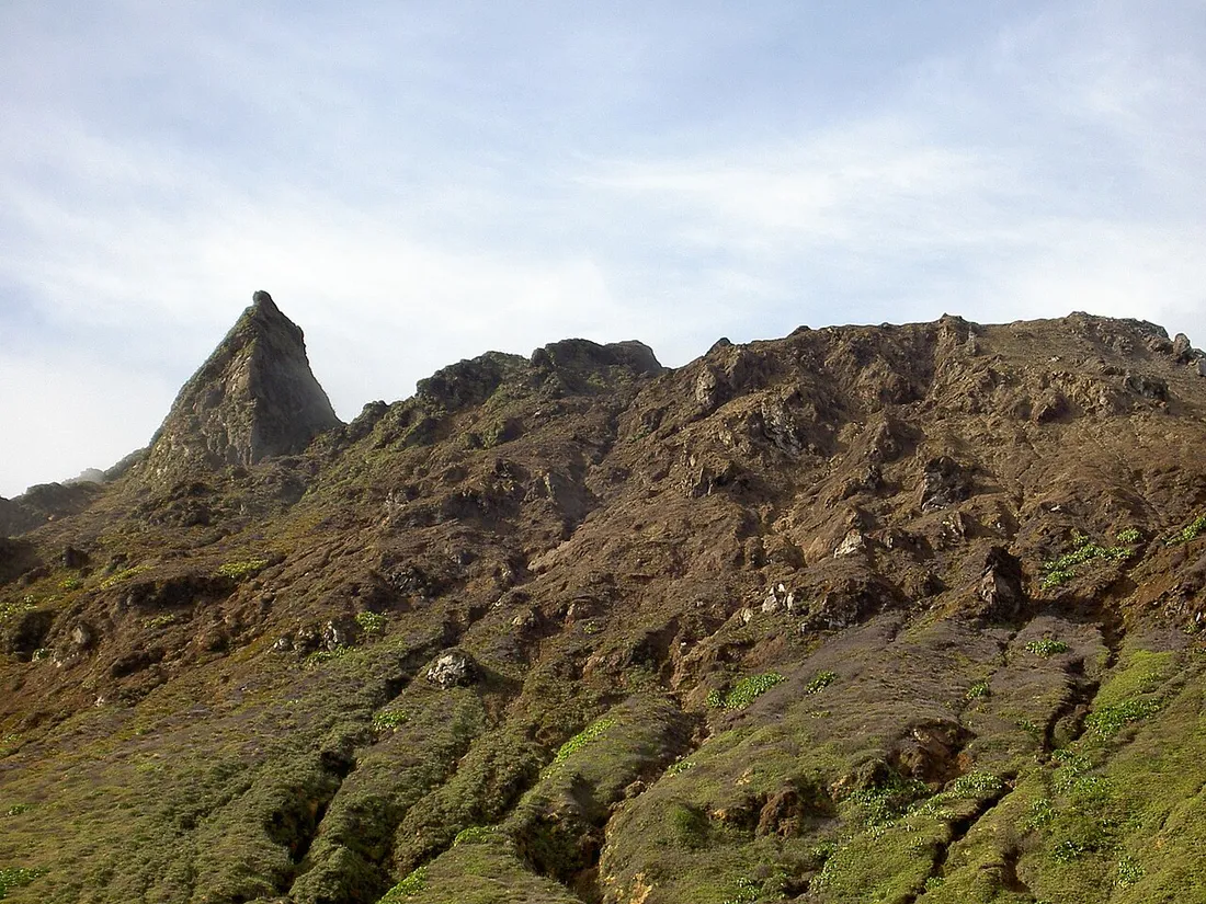
The Soufrière massif is more than just the dome at 1,467 m. All around it, a crown of secondary peaks — Nez Cassé (around 1,380 m), the Grande Découverte, the Échelle — bears witness to ancient eruptive phases. The Tête Allègre area offers the jagged relief of an eroded secondary crater, carpeted with mountain pineapple, thick moss and tree ferns.
What this advanced loop offers beyond the classic climb:
- Solitude: two or three roped parties crossed over the course of a day, versus hundreds of walkers on the Chemin des Dames on a dry-season Sunday.
- 360° panoramas: on a clear day, views over the leeward coast, the Pigeon islets of the Cousteau Reserve, and all the way to Les Saintes to the south.
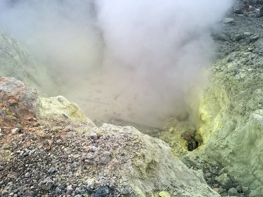
- A true volcanic immersion: fumaroles, the smell of sulfur, ground that’s warm in places, ravines carved into the ash.
- Technical terrain: roots, deep mud, exposed sections along the ridges.
It’s the kind of Basse-Terre volcanic route that turns a beach holiday into a memorable adventure — provided you respect the mountain.
Detailed route of the advanced Soufrière loop
Starting point and access
Start from the Bains Jaunes car park (950 m elevation), in the commune of Saint-Claude, above the town of Basse-Terre. Allow for:
- 1 hr 15 min drive from Sainte-Anne or Le Gosier (about 65 km)
- 50 minutes from Bouillante or Deshaies via the leeward coast
- Free parking, but arrive before 7 a.m.: spots fill up fast and an early start is essential for the weather
The route step by step
- Bains Jaunes → Savane à Mulets via the Pas du Roy trail (45 min, paved and slippery). The ideal warm-up in humid forest.
- Savane à Mulets → Col de l’Échelle: you leave the crowds behind by skirting the dome to the east. First fumaroles, first gusts (1 hr).
- Climb to Nez Cassé: the most technical section. Narrow ridge, stair-step roots, muddy off-camber sections; in strong wind, you move forward hunched over (1 hr 15 min).
- Traverse to the Tête Allègre area: bumps and ravines in the cloud forest, careful navigation as the markings grow sparse (1 hr 30 min).
- Return via the Merwart trail then the Grande Découverte: a long descent, hard on the knees, before looping back to the Bains Jaunes (2 hr to 2 hr 30 min).
Key figures
- Distance: 14 to 16 km depending on the variant
- Elevation gain: 900 to 1,100 m cumulative
- Duration: 6 hr 30 min to 8 hr of actual walking
- Level: difficult, for trained hikers only
- Waymarking: partial; offline GPS track mandatory (no signal over most of the route)
Weather, wind and fumaroles: the real challenges of Nez Cassé
On the Soufrière massif, the real difficulty isn’t the elevation gain: it’s the weather, which changes in fifteen minutes on a summit shrouded in cloud more than 300 days a year.
What awaits you up there
- Rain: 8 to 10 metres of annual rainfall on the massif, one of the wettest spots in the Lesser Antilles. You will get wet, that’s a certainty.
- Wind: frequent gusts of 60–80 km/h on the Nez Cassé ridges. In a sustained trade wind, give up on the traverse.
- Temperature: 12 to 17 °C at the summit, 15 degrees colder than on La Caravelle beach at the same moment. Soaked and windblown, the risk of hypothermia is real.
- Fumaroles: the sulfurous emissions mean you must never linger in marked active zones and must comply with the prefectural access orders, which change with the volcano’s activity. Check the National Park and OVSG websites the day before.
The ideal window
Set off between December and April (dry season), start at 6 a.m. from the Bains Jaunes, with no tropical wave forecast. Only 2 or 3 days a week offer clear ridges: staying nearby for several days to pick your morning is the hiker’s true luxury in Guadeloupe.
Gear: the local hiker’s checklist
After years on these trails, here’s what I always bring:
- High-cut hiking boots with a lugged sole, already broken in — smooth trainers are the leading cause of twisted ankles on volcanic mud
- Waterproof windbreaker with a hood + a warm synthetic layer (wet fleece keeps you warm, cotton doesn’t)
- 2 litres of water minimum per person and salty snacks
- A change of clothes in the car, a bin bag to keep the dry items separate in your backpack
- Offline GPS track, power bank, whistle
- Thin gloves for the ridge sections on roots and abrasive rock
- Trekking poles for the long descent of the Grande Découverte
On budget: no entry fee in the National Park. For a first attempt on this loop, a mountain guide is recommended: expect €45 to €70 per person for the day depending on group size.
Where to stay to start the loop at first light
Sleeping nearby the night before changes everything: you set off fresh, in the right weather window. The best bases:
- Saint-Claude and the heights of Basse-Terre: 15 minutes from the Bains Jaunes, ideal the night before the hike.
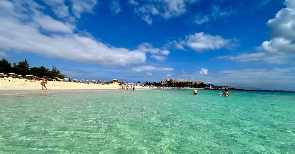
- Bouillante or Deshaies: 50 minutes from the start, with a recovery snorkel the next day in the Cousteau Reserve at Malendure — the combo of volcanic ridges then turtles is the quintessence of Basse-Terre.
- Sainte-Anne or Saint-François: farther out (1 hr 15 min), but perfect for mixing Grande-Terre beaches with nature days.
At Hostel Toucan, our rentals in Guadeloupe are designed for this kind of active stay: direct booking with no platform fees, free cancellation up to 7 days before arrival, and WhatsApp support 7 days a week — handy for asking at 5:30 a.m. whether the road to Saint-Claude is clear. For the rest of your itinerary (the Carbet falls, Les Saintes, Marie-Galante), our complete guide to Guadeloupe gathers our field findings. And if you own a property on the Basse-Terre side, our concierge service for owners makes the most of this hiker clientele, present all year round.
Safety: the non-negotiable rules
- Tell someone your route and your estimated return time.
- Turn back without hesitation if the wind makes the Nez Cassé ridges untenable: the loop can be retried, a fall cannot.
- Never leave the track: ravines hidden by vegetation are real traps.
- Emergencies: 112; check the OVSG for the volcano’s alert level before setting off.
- Carry all your waste back down, fruit peels included.
This advanced Soufrière loop is, in my eyes, the finest mountain day in the French West Indies. Prepare it well, pick your window, and savour it.
FAQ
Is the Tête Allègre and Nez Cassé hike suitable for beginners?
No. It’s a 6 hr 30 min to 8 hr loop with around 1,000 m of elevation gain, wind-exposed ridges and partial waymarking. Beginners should start with the classic Soufrière climb via the Chemin des Dames before considering this variant, or set off with a qualified guide (€45 to €70 per person).
What’s the best time of year for this loop around La Soufrière?
The dry season, from December to April. Start early (Bains Jaunes around 6 a.m.), as clouds cling to the massif from late morning. Avoid the cyclone season (August–October) and any day with a forecast tropical wave.
Do you need special gear for Nez Cassé?
Yes: high-cut boots with a lugged sole, a waterproof windbreaker, a warm layer, 2 litres of water per person, an offline GPS track and a change of clothes in the car. It’s 12 to 17 °C at the summit with strong gusts: hypothermia exists even in the tropics.
Where to stay to be at the start early in the morning?
Saint-Claude is the closest base (15 minutes from the Bains Jaunes); Bouillante and Deshaies let you follow up with the Cousteau Reserve the next day. Hostel Toucan offers rentals with direct booking, no platform fees, free cancellation 7 days out and WhatsApp support 7 days a week.