Some hikes you do for the view, others you do for the sound. The Traversée Trail in Guadeloupe belongs firmly to the second category: under the canopy, rain drumming on the gommier leaves sounds like a gwo ka played by the forest itself. I’ve lived on Basse-Terre for years and I take every one of my visitors here, because it’s the most direct way to understand a true tropical rainforest: 300 species of trees, tree ferns as tall as houses, a constant soundtrack of birds and frogs. Here’s how to prepare for it properly, with no nasty surprises.
The Traversée Trail at a glance: distance, duration, elevation
The trail follows the line of the Route de la Traversée (D23), the only road that cuts across the mountainous wing of the Guadeloupe butterfly from east to west, between Petit-Bourg and the Bouillante coast. The trails waymarked by the Guadeloupe National Park allow an almost complete walking crossing or shorter loops.
- Full crossing (the sporty version): about 16 km, 6 to 7 hours of actual walking, roughly 800 m of cumulative elevation gain. For trained walkers only.
- Maison de la Forêt loops: from 20 minutes to 1 hr 30, ideal for families, starting at around 250 m altitude.
- Climb to the Mamelle de Pigeon (768 m): 1 hr 30 to 2 hr round trip from the Col des Mamelles, steep but short, with an exceptional panorama over the leeward coast and the Cousteau Reserve.
- Cascade aux Écrevisses: 10 minutes one way, a paved trail accessible to strollers, perfect for a first encounter with the Corossol River.
All the National Park trails are free. On the other hand, budget 35 to 45 € per day for a rental car from Pôle Caraïbes airport, essential for getting around, or 45 to 60 € per person for a half-day with a mountain guide.
Access via the Route de la Traversée: where to park, where to start
The D23 is a magnificent but narrow mountain road: 17 km of bends between the Versailles roundabout (Petit-Bourg) on the east side and Mahaut on the Caribbean side. Three trailheads structure the Route de la Traversée on the hiking side:
- La Maison de la Forêt (midway): free parking, interpretive panels, National Park information point. It’s the easiest and busiest starting point; aim for before 9 a.m. to have the undergrowth to yourself.
- Le Col des Mamelles (the high point of the road, just under 600 m): small roadside parking, start of the trails toward the Mamelle de Pigeon and the Mamelle de Petit-Bourg (716 m). Mist is frequent in the afternoon.
- La Cascade aux Écrevisses: large parking lot, very busy on weekends with Guadeloupean families — a good sign of authenticity, but arrive early.
Allow about 30 minutes from Pointe-à-Pitre (25 km), 25 minutes from Deshaies, 35 minutes from Le Gosier. No gas station or shop on the D23: fill up on fuel, water and snacks before Versailles or Pointe-Noire.
The route step by step: what you’ll really see
Under the canopy: giant gommiers and tree ferns
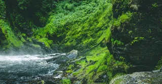
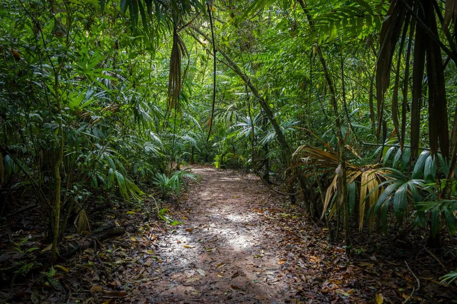
From the Maison de la Forêt, the trail plunges immediately into the dense rainforest. The stars of the route are the white gommiers, smooth columns over 30 metres tall from which the Kalinago Amerindians made their canoes, the large-leaved chestnut trees with their spectacular buttress roots, and the tree ferns that give the undergrowth its Jurassic feel. Look up: the trunks are colonised by bromeliads, wild pineapples and lianas as thick as your arm.
Crossing the rivers
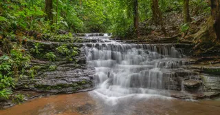
The trail crosses the Corossol River and its tributaries several times, on footbridges or fords. After heavy rain, the fords rise fast: if the water goes above the knee, you turn back — a non-negotiable local rule. In the clear pools, look for the ouassous, the big river prawns emblematic of the island.
The finish at the Col des Mamelles
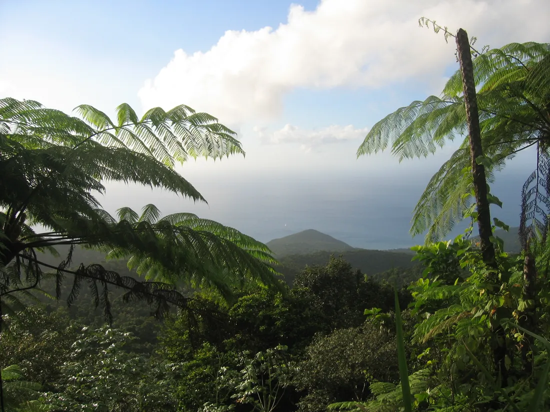
The section that climbs toward the Col des Mamelles is the most demanding: steps cut into the earth, slippery roots, passages where you use your hands. The reward matches the effort: on a clear day from the Mamelle de Pigeon, the view takes in the Bouillante coast, the Pigeon islets of the Cousteau Reserve and, in the distance, the silhouette of La Soufrière (1,467 m).
Rainforest hiking in Guadeloupe: the weather rules everything
This is THE point visitors underestimate. The ridges of Basse-Terre intercept the moisture-laden trade winds: some areas of the massif receive more than 5 metres of rain per year, nearly ten times that of Paris. In practice, for a successful rainforest hike in Guadeloupe:
- Set off early: between 7 and 8 a.m., the chance of clear skies is highest; showers often form in the early afternoon.
- Dry season (December to April): less muddy trails, lower fords — this is the best window.
- Minimum gear: hiking shoes with lugged soles (smooth sneakers are a one-way ticket to a faceplant), 1.5 L of water per person, a light rain jacket, a change of clothes in a waterproof bag for the car.
- Phone: there’s almost no network in the heart of the massif; tell someone your itinerary and download the map offline.
- Rain during the walk: it’s not a failure, it’s the show. Take shelter, listen to the “gwo ka” of the shower on the canopy, set off again twenty minutes later.
Endemic wildlife: keep your eyes open (and above all your ears)
The Traversée forest is one of the best spots in the archipelago for endemic wildlife. My regulars:
- The Guadeloupe woodpecker (“tapé” in Creole): the only woodpecker in the Lesser Antilles, black with purple highlights; you hear it hammering the dead trunks long before you see it.
- The hummingbirds: the purple-throated carib, large and dark, patrols the red heliconias; the Antillean crested hummingbird, tiny, defends its territory with a delightful bad faith.
- Pinchon’s whistling frog: this little invisible frog provides, from late afternoon, the characteristic high-pitched soundtrack of Guadeloupean nights.
- The anoles: little green lizards everywhere on the trunks, perfectly harmless.
Good news for anxious walkers: there are no venomous snakes in Guadeloupe, unlike neighbouring Martinique. The only real danger on the trail remains slipping.
Where to stay to explore the Traversée and the rest of Basse-Terre
The winning trio, tested with dozens of travellers: stay on the Caribbean side in Bouillante or Deshaies (25-35 minutes from the trailheads), do the Traversée early in the morning, then finish with snorkelling at Malendure or a sunset at Grande Anse.
That’s exactly what Hostel Toucan offers: holiday rentals hand-picked on both wings of the butterfly, with direct booking and no platform fees, free cancellation up to 7 days before arrival and WhatsApp support 7 days a week — handy when you want a local weather opinion before committing to the Col des Mamelles. Browse our Guadeloupe rentals to find your base camp, and pick up more itinerary ideas in our complete guide to Guadeloupe. Do you own a property near the Route de la Traversée or on the leeward coast? Our concierge service handles everything, from guests to cleaning: head over to our owners page.
FAQ
Is the Traversée Trail doable with children?
Yes, by choosing the right section: the Cascade aux Écrevisses (10 minutes, flat trail) and the small Maison de la Forêt loop are suitable from age 3-4. The Mamelle de Pigeon and the full crossing require real mountain legs: save those for teenagers used to walking.
What’s the best time to hike the Route de la Traversée?
The dry season, from December to April: less muddy trails, low rivers, more often clear skies. The rest of the year, set off before 8 a.m. and give up if the rivers are in spate.
Do you need a guide for the full crossing?
It’s not compulsory; the National Park trails are waymarked. For the full 16 km version, however, a guide (45 to 60 €/person) brings the shuttle logistics between the two ends of the D23 and a fascinating reading of the forest.
Can you swim during the hike?
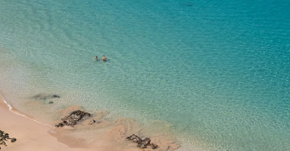
Yes, and it’s one of the great pleasures of the route: the pool at the Cascade aux Écrevisses and several basins of the Corossol River are perfect for it, in water at 22-24 °C. Avoid swimming after heavy rain and leave no valuables visible in the car.