If you’re looking for a hike on Terre-de-Haut in Les Saintes that goes beyond the classic postcard views, the Trace des Contrebandiers (Smugglers’ Trail) is the one I recommend to our travelers every time. This path, inherited from the discreet routes between the coves of the island’s southwest, links wind-swept panoramic ridges with descents to often-deserted creeks, even in high season. On paper it’s short — Terre-de-Haut is only 6 km long — but the Saintes sun, the lack of shade up on the heights and the broken, rocky terrain make it a real outing that needs planning. Here’s everything you need to know, field-tested between December and April.
Why the Trace des Contrebandiers is the finest hike on Terre-de-Haut
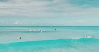
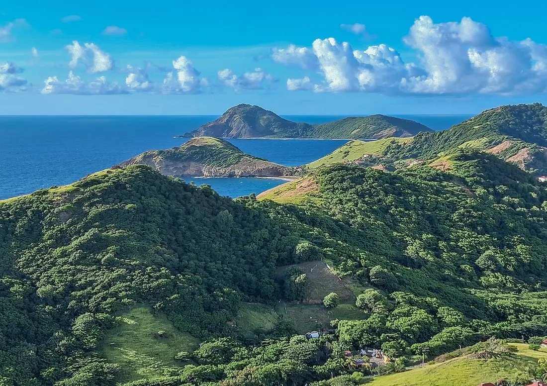
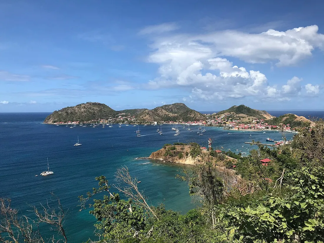
The bay of Les Saintes is ranked among the most beautiful bays in the world, and most visitors discover it from the village or the Fort Napoléon. The Trace des Contrebandiers offers the opposite angle: you turn your back on the bay to swing over to the wild coast, the one that faces Dominica on a clear day.
In practical terms, the trail links the Bois Joli and Anse à Cointre area to the southwest creeks, passing over the ridges of the morne. What makes the route unique:
- 360° panoramas: from the ridges, you take in the bay of Terre-de-Haut on one side, Terre-de-Bas and the Saintes channel on the other, with the silhouette of the Soufrière of Basse-Terre as a backdrop to the north.
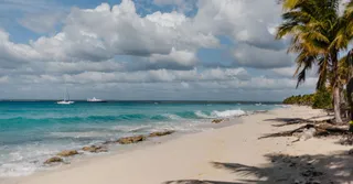
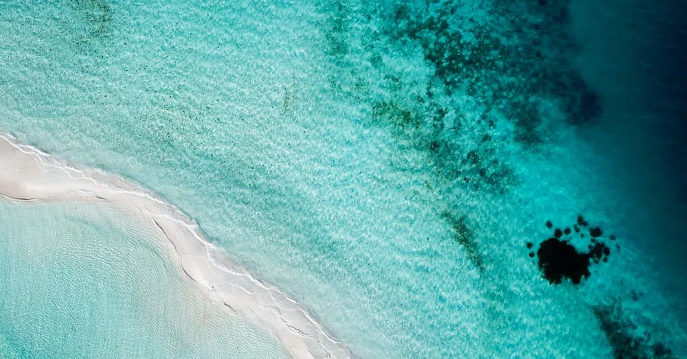
- Secluded coves as a reward: Anse Crawen (pebble beach, excellent snorkeling) and the Anse Rodrigue area, reachable on foot only or nearly so, stay quiet even when the village beaches are packed.
- Typical dry vegetation: candle cacti, sea grapes, red gum trees and Lesser Antillean iguanas basking on the rocks — keep your eyes open, we spot them on almost every outing.
- A genuine sense of history: the trail’s name recalls the era when goods moved discreetly between the coves, out of sight of the village.
Difficulty and who it suits
The trail is rated easy to moderate. Expect a cumulative elevation gain of around 150 to 200 m depending on the variant you choose. The ridge sections are stony and at times steep over short stretches: good sneakers are enough, but forget the flip-flops. Children from 7-8 years old who are used to walking manage very well in the morning, before the big heat.
Detailed itinerary: duration, distances and waypoints
The classic route from the village
Here’s the itinerary I recommend, in the direction that keeps the sun at your back in the morning:
- Terre-de-Haut village → Bois Joli: 30 to 40 minutes of walking along the coast road (about 2 km), or 5 minutes by scooter. The start of the trail is signposted on the Anse à Cointre side.
- Climb onto the ridges: 25 to 35 minutes of gradual ascent. This is the most exposed stretch — no shade, but the trade winds almost always blow.
- Ridgeline and viewpoints: 30 minutes of pure pleasure, with the best views on the island over the wild coast and Terre-de-Bas.
- Descent to Anse Crawen: 20 minutes on a stony path. Swimming and snorkeling possible (pebbles: bring water shoes).
- Return via Pompierre or the village: 40 to 50 minutes depending on the variant.
Realistic assessment: 2.5 to 3.5 hours of actual walking for 7 to 8 km in total from the village, swim breaks not included. Setting off from the landing stage at 8:30 a.m., you’ll wrap up comfortably before lunch.
The variant with Fort Napoléon
If you only have one day on the island, combine the trail with the Fort Napoléon path, which overlooks the bay north of the village: 25 minutes of climbing from the landing stage, entry around €6 (museum and cactus garden, iguanas guaranteed). Visit the fort as soon as it opens around 9 a.m. (it closes in the early afternoon), then move on to the Trace des Contrebandiers. The full day amounts to 12 to 14 km: doable, but reserve it for strong walkers.
Anse Rodrigue, the detour worth it
On the east side of the southern point, Anse Rodrigue is a light-sand beach, calm and little visited, ideal for ending the loop with a swim. With Anse Crawen and Pompierre beach, you have the trio that justifies spending at least one night on Terre-de-Haut rather than visiting it on a quick day trip.
Water, sun, gear: what makes the difference in Les Saintes
This is the point I stress most with our travelers: Terre-de-Haut is a dry island, far more arid than neighboring Basse-Terre. There is no water source and no reliable shade on the ridges.
- Water: 1.5 L minimum per person for the trail alone, 2 L if you combine it with the fort. This is non-negotiable, even “for just 3 hours.”
- Timing: set off before 9 a.m., no exceptions. Between 11 a.m. and 3 p.m., the glare off the rocks turns the ridges into an oven.
- Protection: hat, sunglasses, SPF 50 cream. The wind masks the sensation of burning — that’s the classic trap.
- Footwear: sneakers with a lugged sole. The volcanic ground rolls underfoot on the descents.
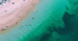
- Snorkeling: mask and snorkel in the bag, the seabed of Anse Crawen (parrotfish, sometimes turtles) deserves it.
- Season: December to April, the dry season, offers the ideal conditions and the best visibility toward Dominica.
Getting there: the crossing from “mainland” Guadeloupe
The ferries leave mainly from Trois-Rivières (20-25 minute crossing, the shortest) and from Pointe-à-Pitre (about 1 h). Budget €25 to €32 round trip per adult depending on the company and the port. First departure around 7:45-8 a.m. from Trois-Rivières: that’s the one to aim for to hike at the right hours. Be aware, the Saintes channel can be choppy — if you’re prone to seasickness, take precautions and sit at the back of the boat.
Once there, everything is done on foot, or by electric scooter (€35 to €45 a day) if you want to chain beaches and viewpoints without overexerting.
Where to stay to enjoy Les Saintes without chasing the ferry
The day trip works, but it ties you to the boats’ schedule and deprives you of the most magical moment: the bay at sunset, when the last visitors have left. Two strategies we recommend at Hostel Toucan:
- South Basse-Terre base: a place between Trois-Rivières and Capesterre-Belle-Eau puts you less than 15 minutes from the embarkation point, with the Carbet falls and the Soufrière as a bonus on the other days.
- Grande-Terre base: from Sainte-Anne, Saint-François or Le Gosier, count 1 h to 1 h 15 of driving to Trois-Rivières — workable with an early start, and you keep the beaches of La Caravelle and the Pointe des Châteaux within reach.
Browse our rentals in Guadeloupe: direct booking with no platform fees, free cancellation up to 7 days before arrival, and WhatsApp support 7 days a week — handy when you’re looking for the time of the last ferry or a plan B in case of rough seas. Our guests also receive a local address book with our tested itineraries, including this trail, and you can plan the rest of your stay with our complete guide to Guadeloupe. Own a property in the archipelago? Our concierge service supports owners from A to Z.
FAQ
How long does the Trace des Contrebandiers on Terre-de-Haut take?
Count on 2.5 to 3.5 hours of actual walking for the full loop from the village (7 to 8 km), swim breaks not included. Combining it with the Fort Napoléon path, plan on the whole day and 12 to 14 km in total.
Is the hike doable with children?
Yes, from 7-8 years old for children used to walking, setting off early in the morning. The ridge sections are stony but never dangerous as long as you stay on the trail. The essentials are water (1.5 L per person minimum) and sun protection, since there is no shade up on the heights.
Can you swim along the route?
Yes, that’s actually the whole point: Anse Crawen (pebbles, excellent snorkeling) lies at the foot of the descent, and Anse Rodrigue along with Pompierre beach round out the loop. Bring a mask, snorkel and water shoes to enjoy the seabed.
Should you sleep in Les Saintes or come for the day?
The day round trip from Trois-Rivières (20-25 minute crossing, €25-32 round trip) is enough for the trail alone. But a night on the island gives you the island without the crowds, the sunset over the ranked bay and a hike departure during the cool hours — the option we recommend to our travelers when the schedule allows.