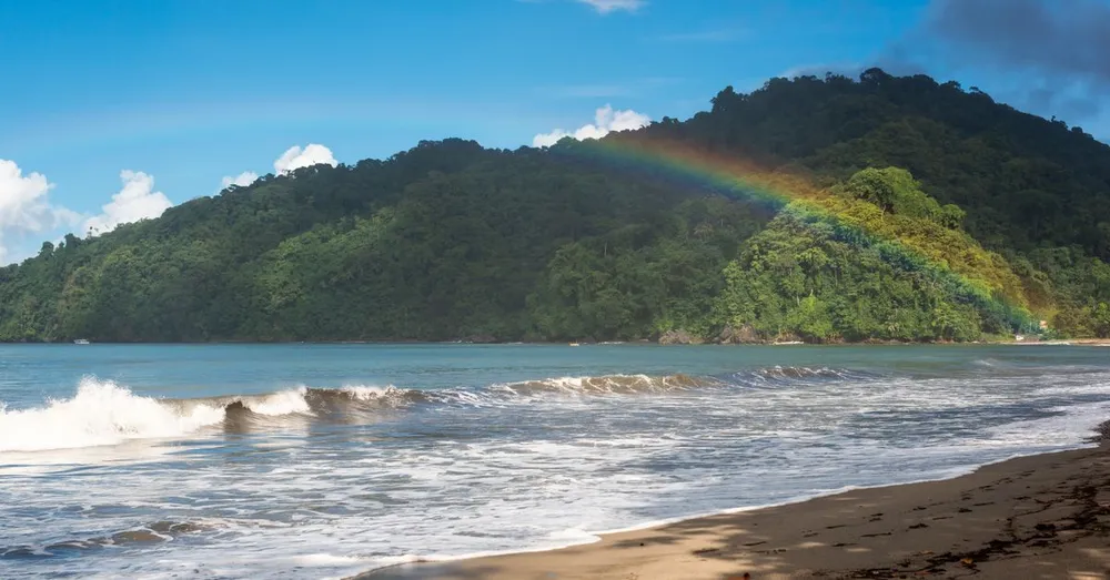
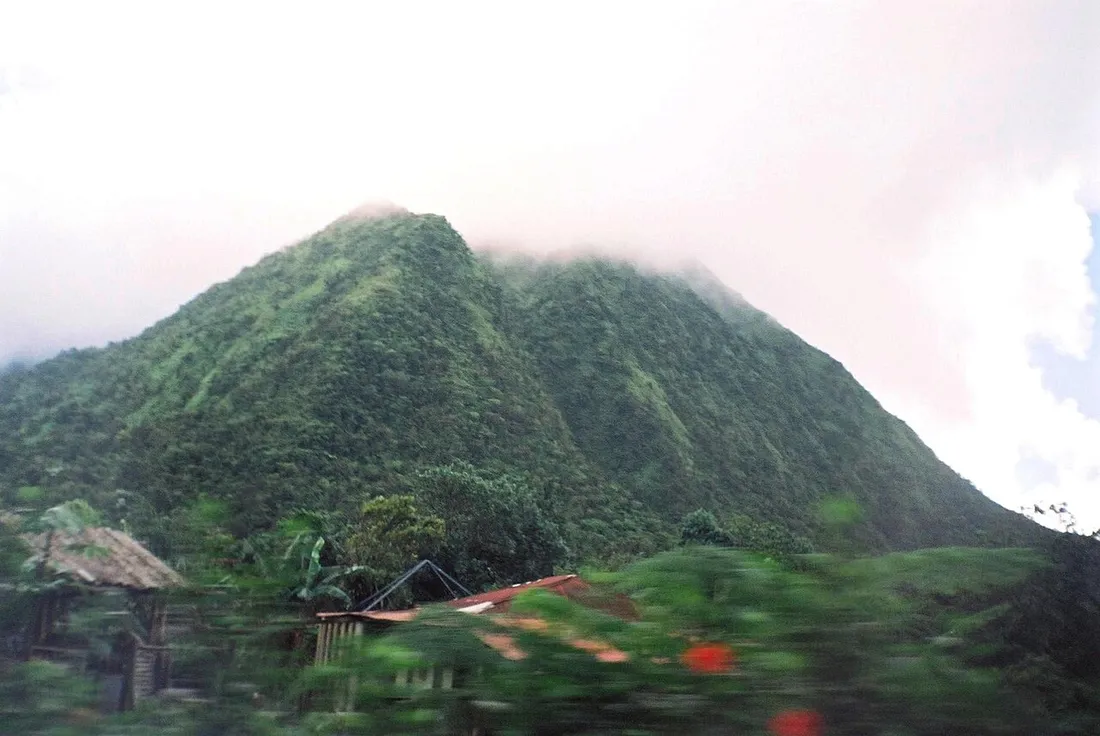
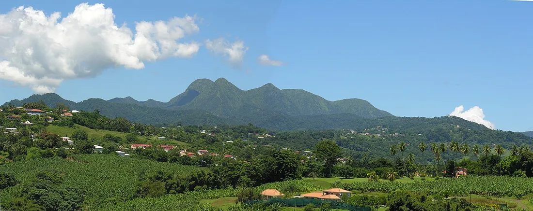
When you look up from Fort-de-France, it isn’t the southern beaches that dominate the horizon, but a jagged ridge, often crowned with clouds: the Pitons du Carbet. This ancient volcanic massif, older than Mount Pelée, peaks at 1,196 m at Piton Lacroix (also called Piton du Carbet) and offers some of the wildest and most demanding hikes on the island. There’s no Sunday stroll in flip-flops here: we’re talking permanent mud, fixed ropes, slippery roots and an elevation gain that forgives nothing. But at the summit, the reward is rare in Martinique: a sweeping view over the entire Bay of Fort-de-France, from the Trois-Îlets peninsula all the way to the Caribbean Sea.
This article is for those still hesitating: what level do you really need, which way should you go, and how do you organize the trip from your rental? Here’s the on-the-ground report, without sugarcoating.
Understanding the massif: five pitons, two objectives
The Pitons du Carbet form a group of five main summits: Piton Lacroix (1,196 m, the high point), Piton Dumauzé (1,109 m), Piton Boucher (1,070 m), Piton de l’Alma and Morne Piquet. They tower over the communes of Le Carbet, Fort-de-France and Saint-Joseph.
For hikers, two objectives come up most often:
- Piton Lacroix, the highest and most technical, with its famous ropes in the final section.
- Piton Boucher and Piton Dumauzé, often linked together in a loop, slightly more accessible but far from easy.
The most practical access is via the l’Alma sector, on the Route de la Trace (the D1), between Fort-de-France and Saint-Pierre. It’s the starting point known to every local guide.
Why these summits are “committing”
The word comes up constantly in trail guides, and it’s no marketing gimmick. Three concrete reasons:
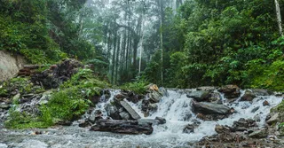
- Permanent mud. The massif receives 5,000 to 8,000 mm of rain per year. Even at the height of the dry season, the trails stay waterlogged and slippery. You walk through a clay that swallows your shoes.
- Fixed ropes. On the final climb of Lacroix, several rock steps are tackled using arm strength, on ropes installed by hiking associations. They are inspected, but the passage remains dizzying.
- Ridge terrain. Once on the summit ridge, the trail becomes narrow, with drop-offs on either side and low vegetation battered by the wind.
The routes in detail
Piton Lacroix from l’Alma
This is the marquee climb. Plan for roughly 8 to 10 km round trip with an elevation gain of 700 to 800 m and a duration of 6 to 8 hours depending on your pace and the state of the trail.
The profile:
- Easy start in humid forest from l’Alma, on a trail that’s gentle at first.
- Gradual climb through the hygrophilous forest, roots and natural steps.
- An intermediate section where the slope steepens noticeably.
- Technical final third: rope sections, rock steps, mixed rock-and-mud terrain up to the summit at 1,196 m.
Required level: experienced and fit. Good physical condition alone isn’t enough; you need to be comfortable using your hands and free of any fear of heights.
Piton Boucher and Piton Dumauzé as a loop
For a day just as beautiful but a notch below in pure technical difficulty, the Boucher-Dumauzé loop is a credible alternative. Plan for 5 to 7 hours and a cumulative elevation gain of about 600 to 700 m. You’ll find the same mud and a few ropes, but the exposed sections are shorter than on Lacroix.
It’s often the recommended choice for a first experience in the massif, before daring the high point.
Morne Piquet, the warm-up
If you want to test the terrain without committing to a full day, Morne Piquet (around 1,160 m) can be climbed in 3 to 4 hours round trip. The panorama over the neighboring pitons is already superb, and it’s an excellent test of your tolerance for Caribbean mud.
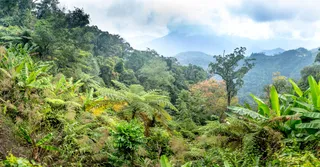
The view: what justifies the effort
In clear weather, the summit of Lacroix opens up a 360° panorama:
- To the south, the Bay of Fort-de-France, the Trois-Îlets peninsula and Diamond Rock in the background.
- To the north, the massive silhouette of Mount Pelée and the coast of Saint-Pierre.
- To the east, the inland mornes and, with luck, all the way to the Caravelle peninsula.
The key phrase: in clear weather. The Pitons du Carbet catch clouds almost constantly. To maximize your chances of a view, set out early, very early.
A local’s practical advice
When to go
The ideal window is the dry season, the Carême, from December to April. Even then, don’t count on a dry trail: simply aim for less waterlogged ground and better visibility. Set out at daybreak (around 6–6:30 a.m.): the summits often clear in the morning before the clouds rise again in the afternoon.
Avoid the days after heavy rain: the mud becomes dangerous and the ropes slippery.
Essential gear
- High-cut hiking boots with deep lugs (and accept that they’ll come out wrecked).
- Light gloves for the ropes.
- 2 liters of water minimum, salty and sweet snacks.
- Windbreaker / rain jacket: it can be cool at altitude and rain without warning.
- Telescopic poles for the muddy descent.
- A charged phone, but don’t count on coverage at altitude.
Safety
- Never go alone on Lacroix.
- Tell someone your route and your estimated return time.
- If in doubt about the weather or your level, hire a qualified mid-mountain guide: count on €40 to €70 per person depending on the outing. It’s the wisest option for a first attempt.
- The emergency number is 112 (local code +596).
Access and logistics
Aimé Césaire Airport (Le Lamentin) is about 30–40 minutes from the l’Alma trailhead. A car is indispensable: no public transport seriously serves the Route de la Trace early in the morning. The l’Alma parking lot is free but limited; arrive before 7 a.m. to avoid driving in circles.
Organizing your hiking stay around the Pitons
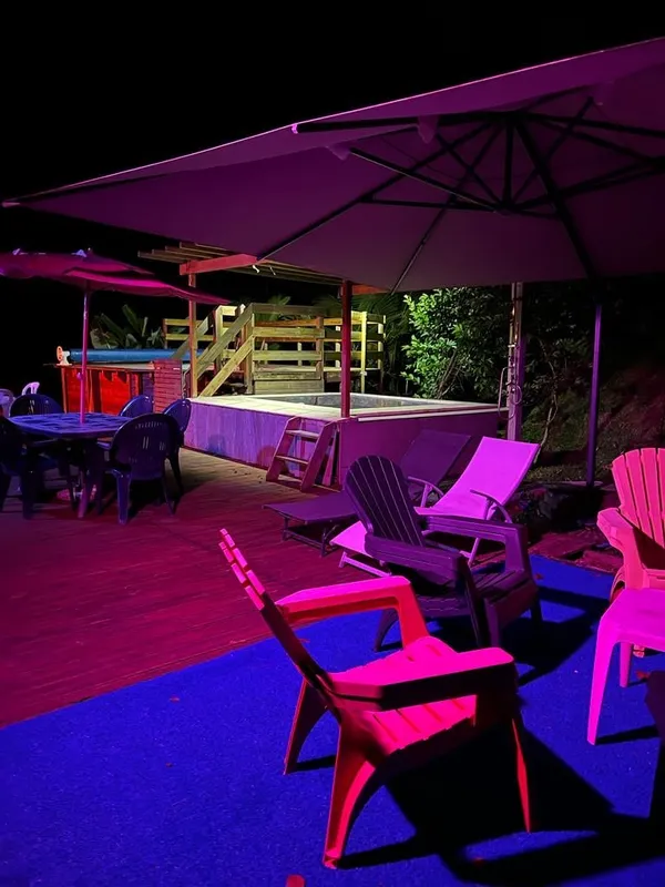
A hike of the Pitons du Carbet is all the more enjoyable when you sleep nearby. Staying in the center of the island (Fort-de-France, Saint-Joseph, Le Carbet) spares you an hour of driving at wake-up and leaves your afternoon free for the Rum Route (Depaz distillery in Saint-Pierre, Clément in Trois-Îlets) or the UNESCO-listed ruins of Saint-Pierre.
At Hostel Toucan, we select accommodations designed for active travelers: proximity to trailheads, space to dry out your gear, and genuine on-the-ground advice. Direct booking carries no platform fees, cancellation is free up to 7 days before arrival, and our WhatsApp support answers 7 days a week — handy for adjusting your program if the piton weather forces you to postpone a day.
To go further, check out our complete guide to Martinique, explore our rental accommodations in Martinique, and if you own a property in the region, discover our concierge services for owners.
Should you really take it on?
Let’s be honest: the Pitons du Carbet aren’t a “love at first sight” hike for everyone. If you’re looking for an easy panoramic stroll, the Balata Garden or the Caravelle peninsula will satisfy you more. But if you love raw effort, primary tropical forest, ropes and the satisfaction of having earned every meter of view, then Lacroix and Boucher rank among the finest outings in the French Antilles.
Prepare seriously, choose your weather window, and treat yourself to the summit that towers over Fort-de-France.
FAQ
What level do you need to climb Piton Lacroix?
An experienced, fit level. Beyond physical condition, you need to be comfortable using fixed ropes, free of any fear of heights, and willing to accept very muddy terrain. For a first time in the massif, it’s better to start with Morne Piquet or the Boucher-Dumauzé loop, or go with a qualified guide.
How long does climbing the Pitons du Carbet take?
Plan for 6 to 8 hours round trip for Piton Lacroix (700–800 m of elevation gain), 5 to 7 hours for the Boucher-Dumauzé loop, and 3 to 4 hours for Morne Piquet. Times vary greatly depending on the muddy state of the trail and your pace.
What is the best time to hike in the Pitons du Carbet?
The dry season, the Carême, from December to April, offers the best conditions and the best visibility. Even then the trail stays muddy. Set out at daybreak (6–6:30 a.m.): the summits often clear in the morning before the clouds rise again.
How do you reach the l’Alma trailhead?
The trailhead is at l’Alma, on the Route de la Trace (D1) between Fort-de-France and Saint-Pierre, 30–40 minutes from Aimé Césaire Airport. A car is indispensable because no public transport serves the site early in the morning. Parking is free but limited: arrive before 7 a.m.